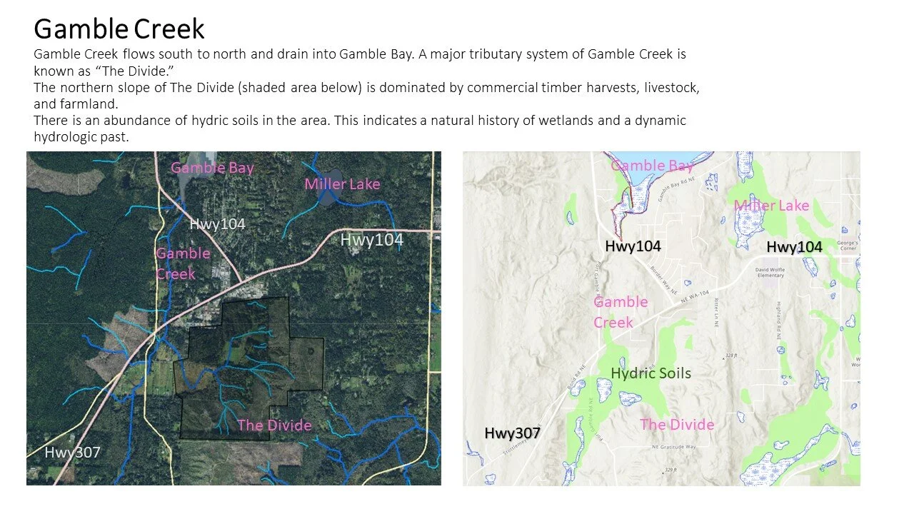
Gamble Creek
7°47'43.5"N 122°34'40.0"W
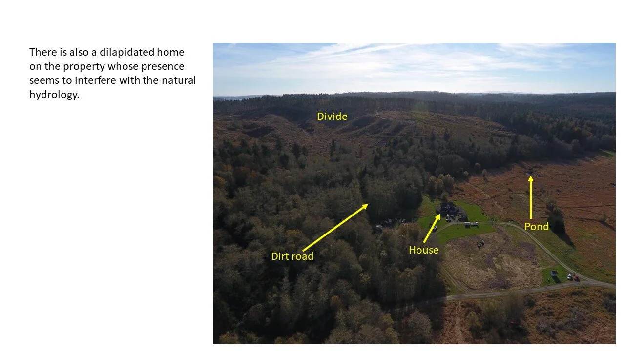
Site Overview
Gamble Creek is the largest creek draining into the Gamble Bay and has been subject to countless human-caused degradations to the watershed. Restoring, enhancing, and preserving the Gamble Creek watershed will benefit the town, the tribe, outdoor recreationalist, the substantial shellfish beds, the salmon runs, and innumerable wildlife species that call the area home.
PROJECT OVERVIEW BULLET POINTS
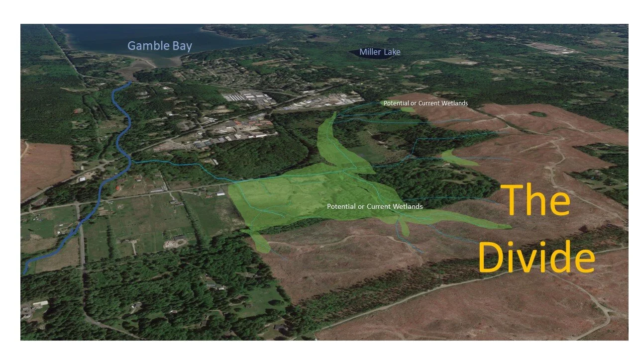
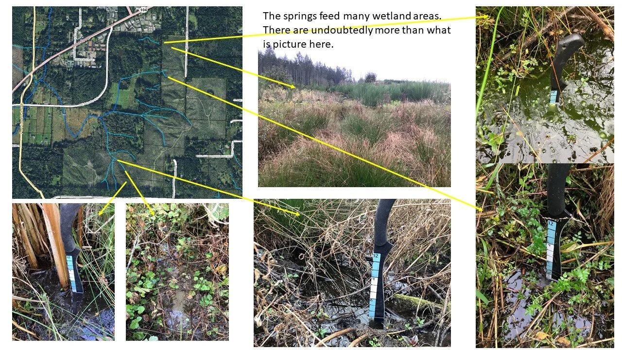
This site encompasses multiple tributary creeks of Gamble Creek.
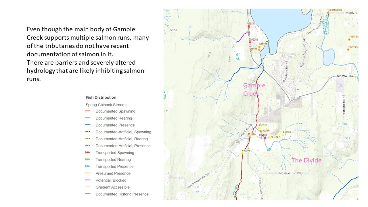
Gamble Creek supports multiple salmon runs that would benefit from restoring the natural hydrology of the area.
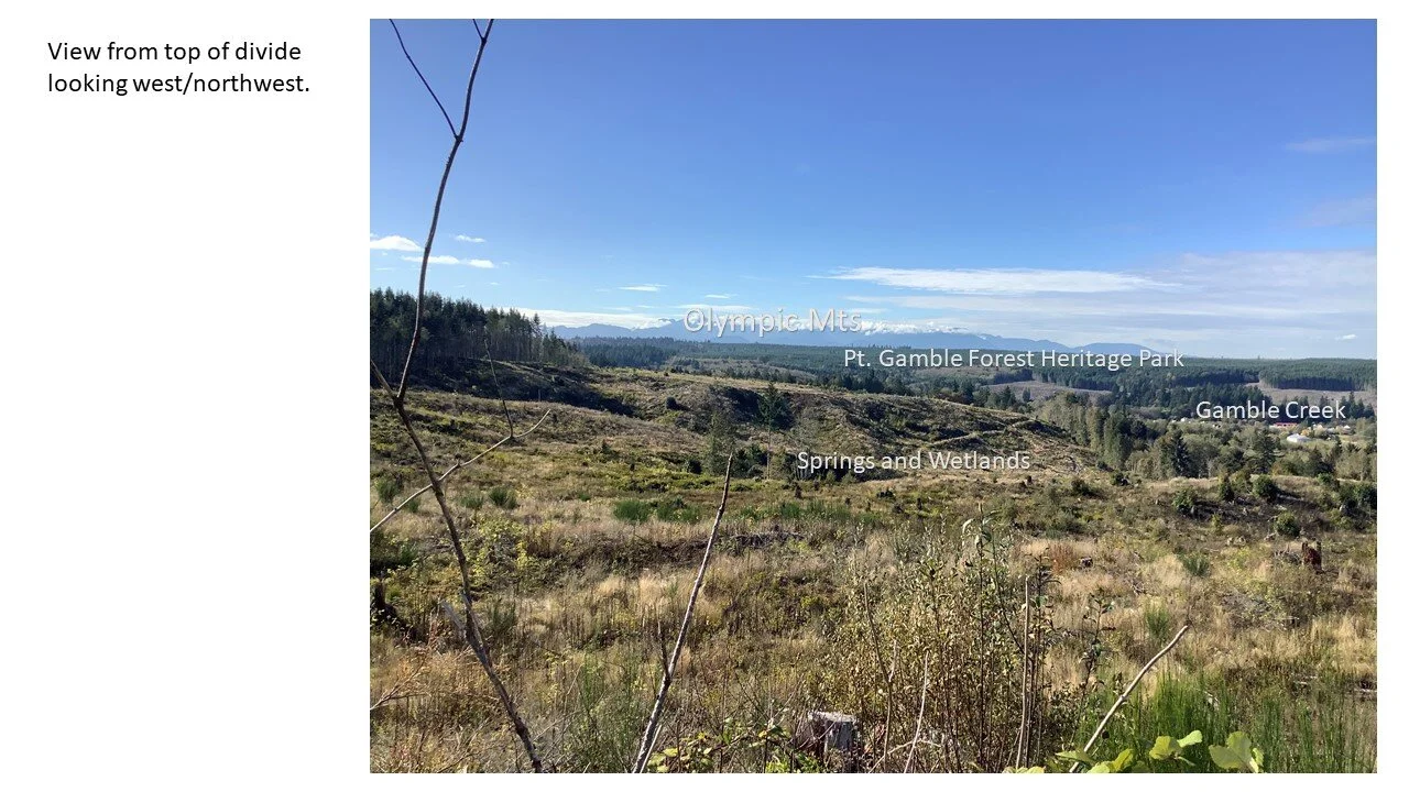
The waters ultimately drain into Gamble Bay which is the site of another significant restoration effort of WMP.
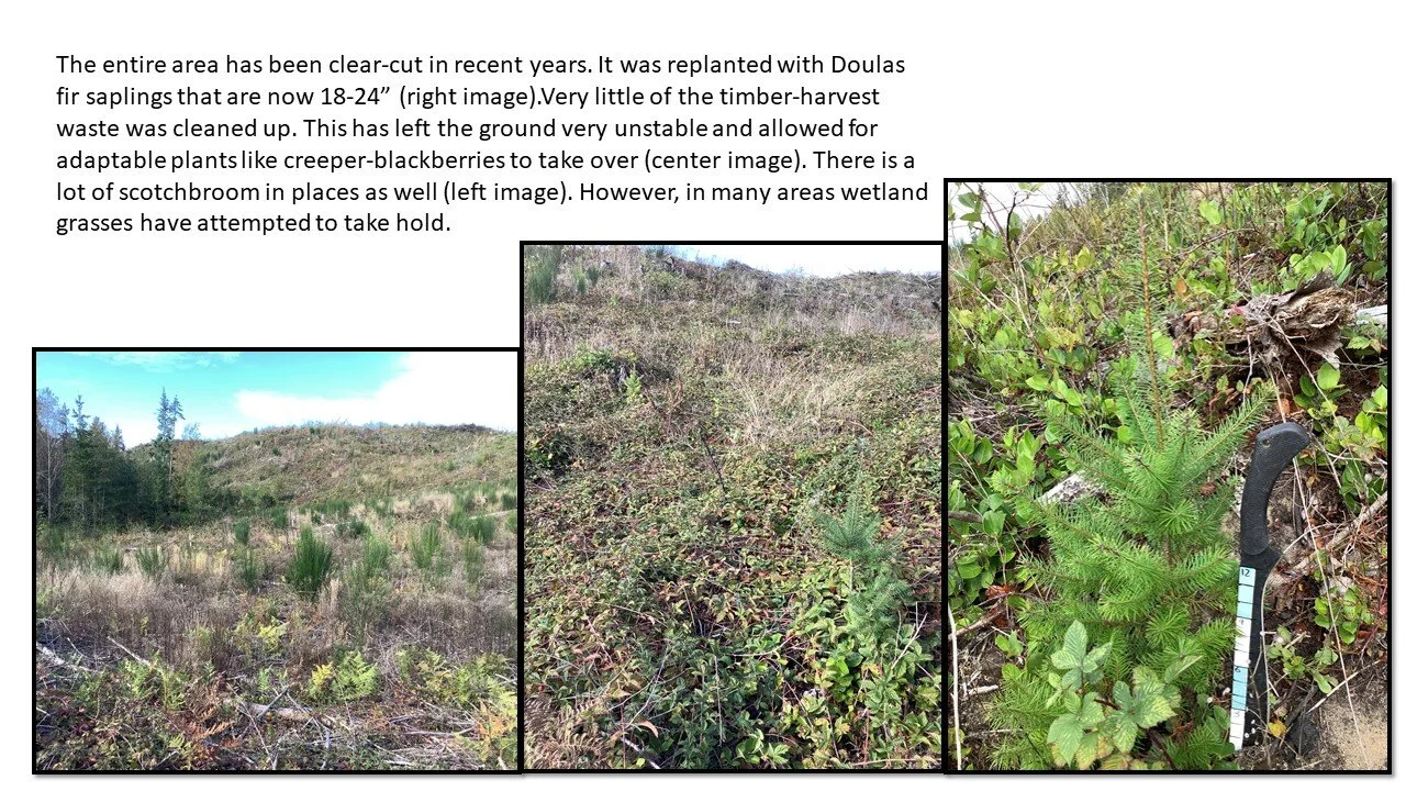
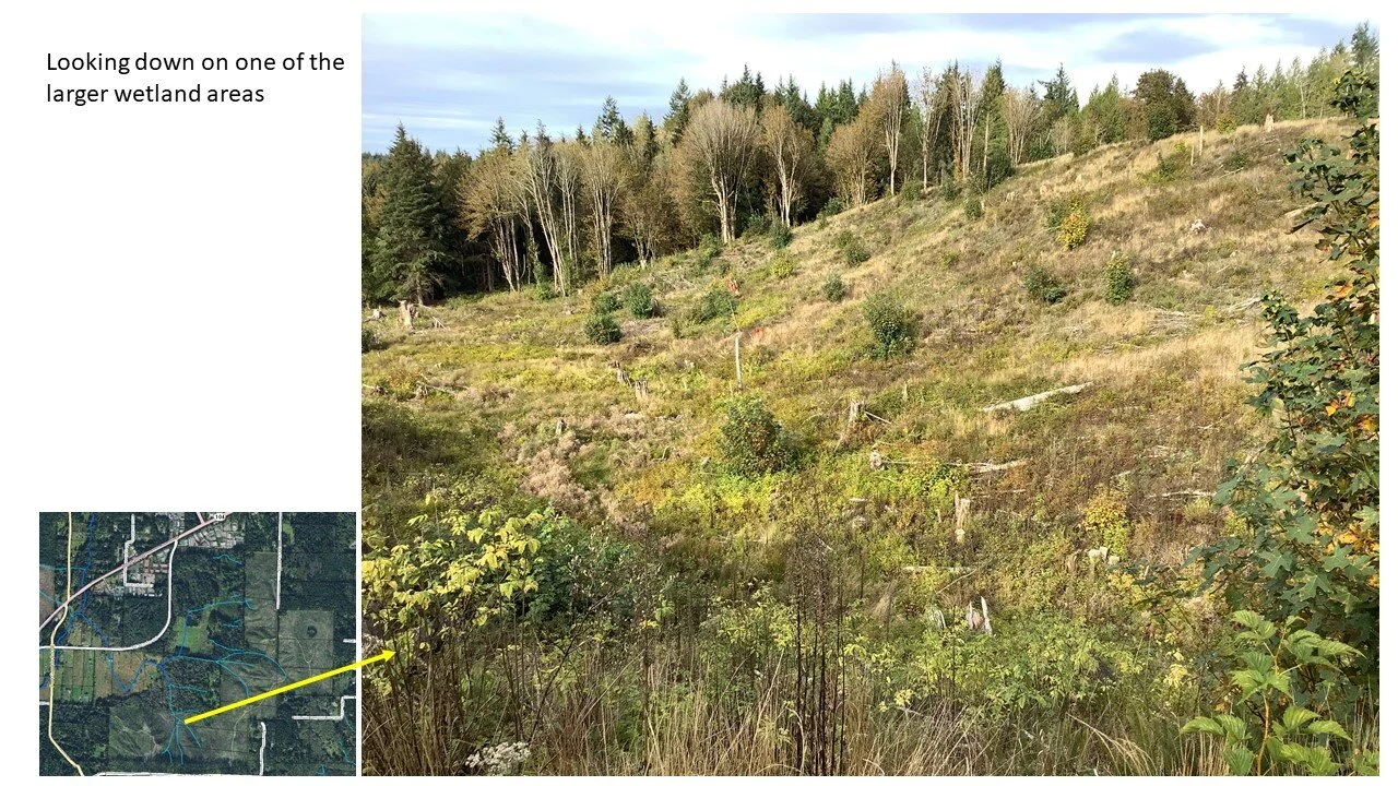
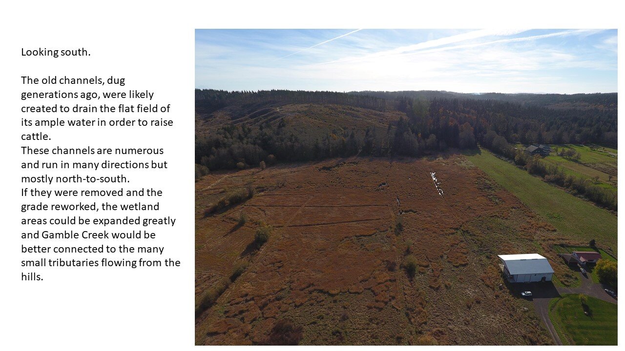
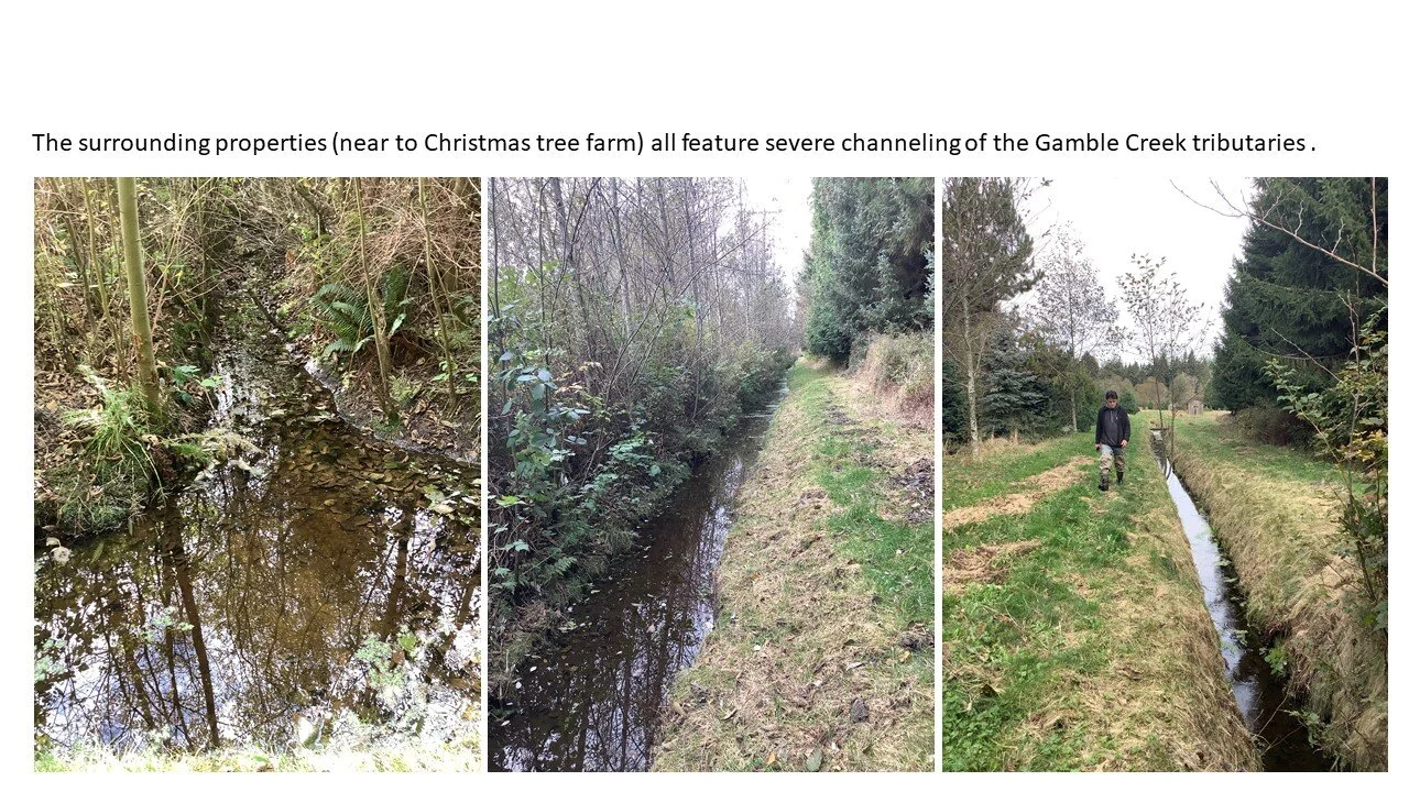
The tributary creeks have been degraded and altered in many ways including clear-cut timber harvests and the channeling of creeks to drain large fields.
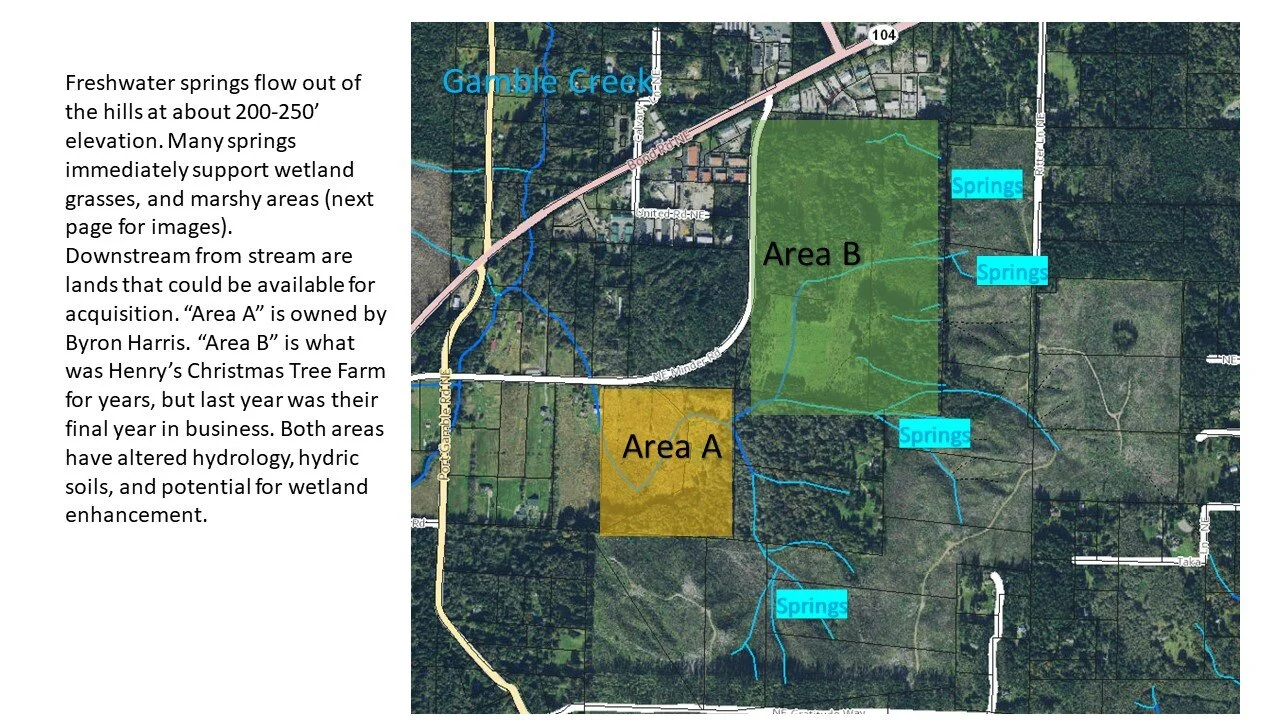
The wetland areas have a recent history and possible future of livestock grazing, agriculture, timber harvest, and Christmas tree farming.
Removing hydrologic barriers, invasive and unwanted species, and revegetating the landscape will provide significant uplift to the Gamble Creek watershed.
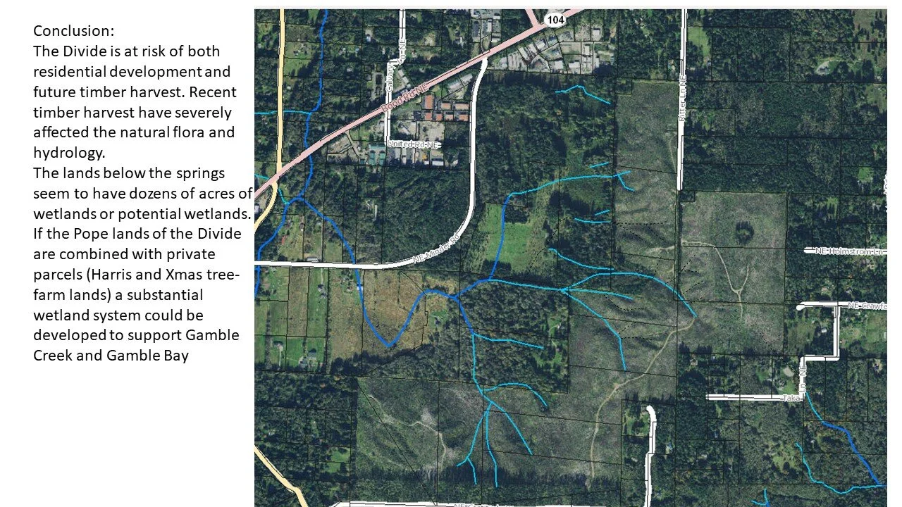
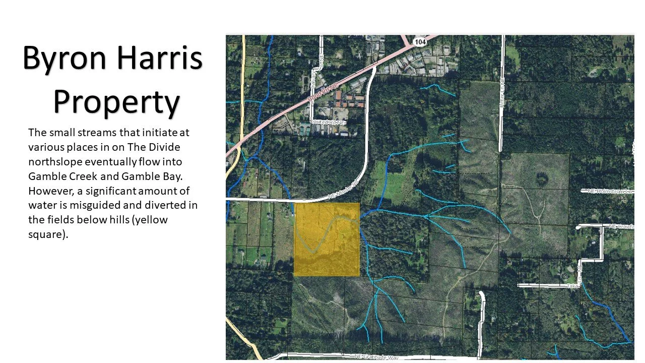
There are substantial wetland restoration and enhancement opportunities among the degraded tributary parcels that are part of our project plans.
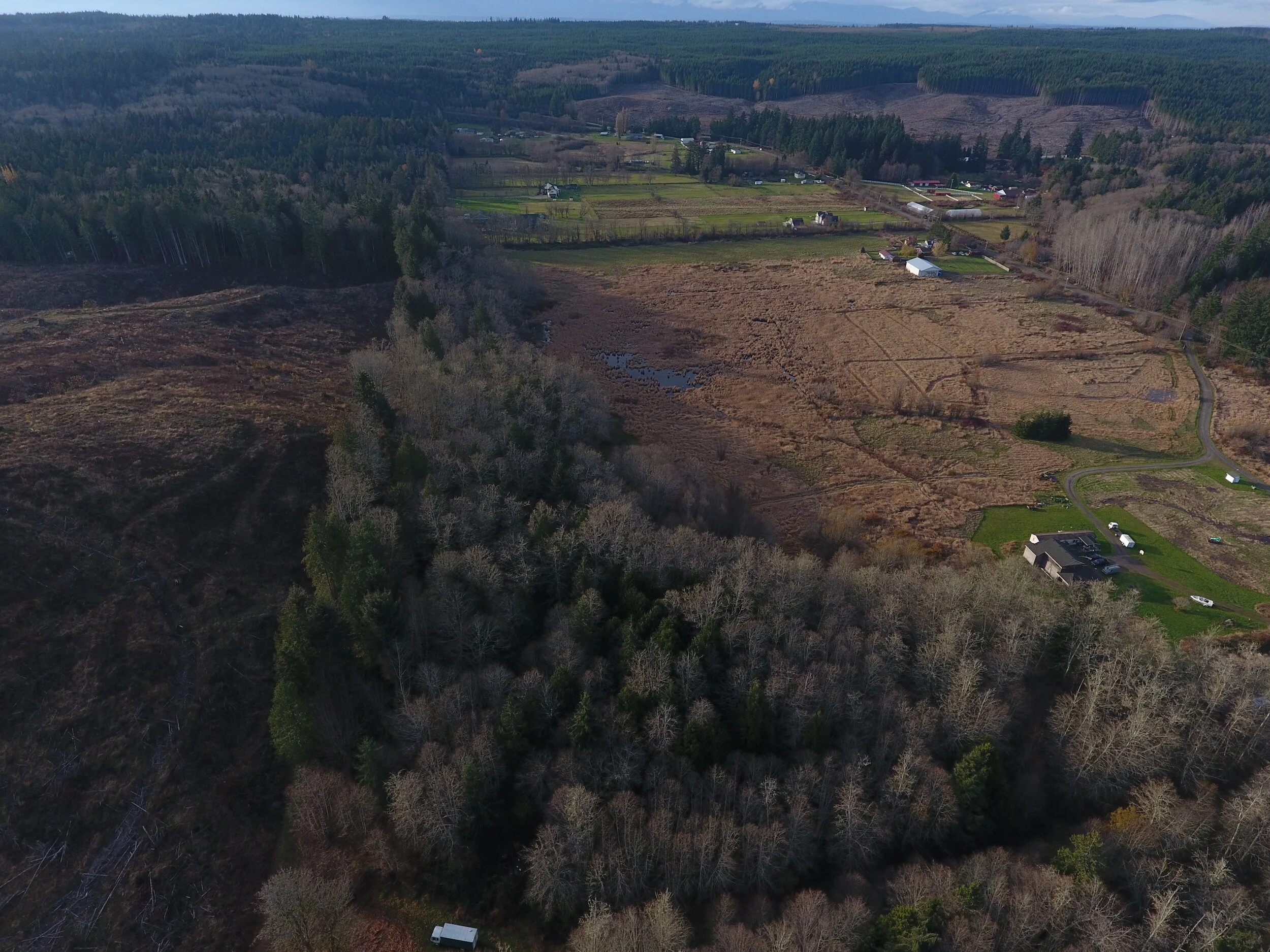
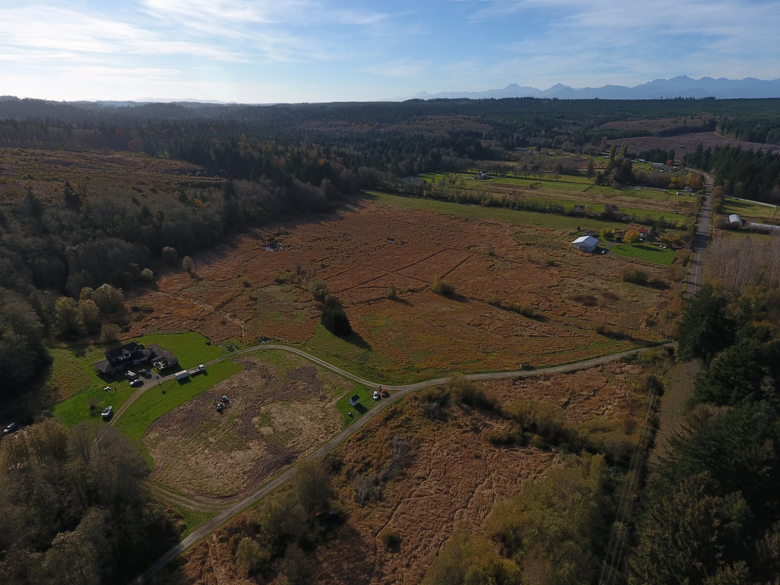
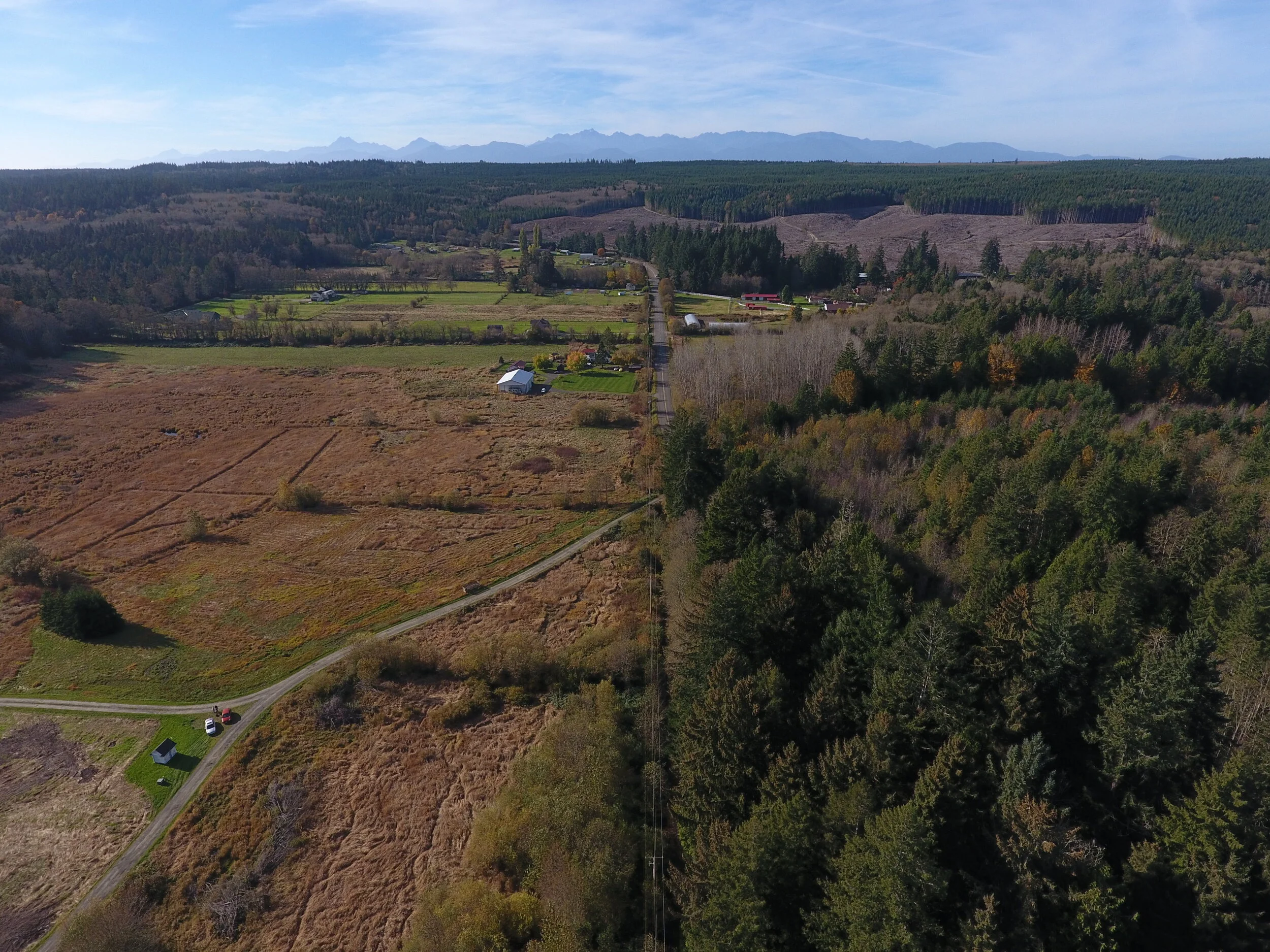
Project Site Drone Overview
Aerial footage displays the area around the Gamble Creek watershed.
Gamble Creek Aerial Video

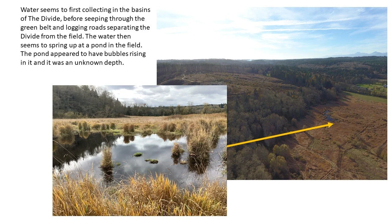
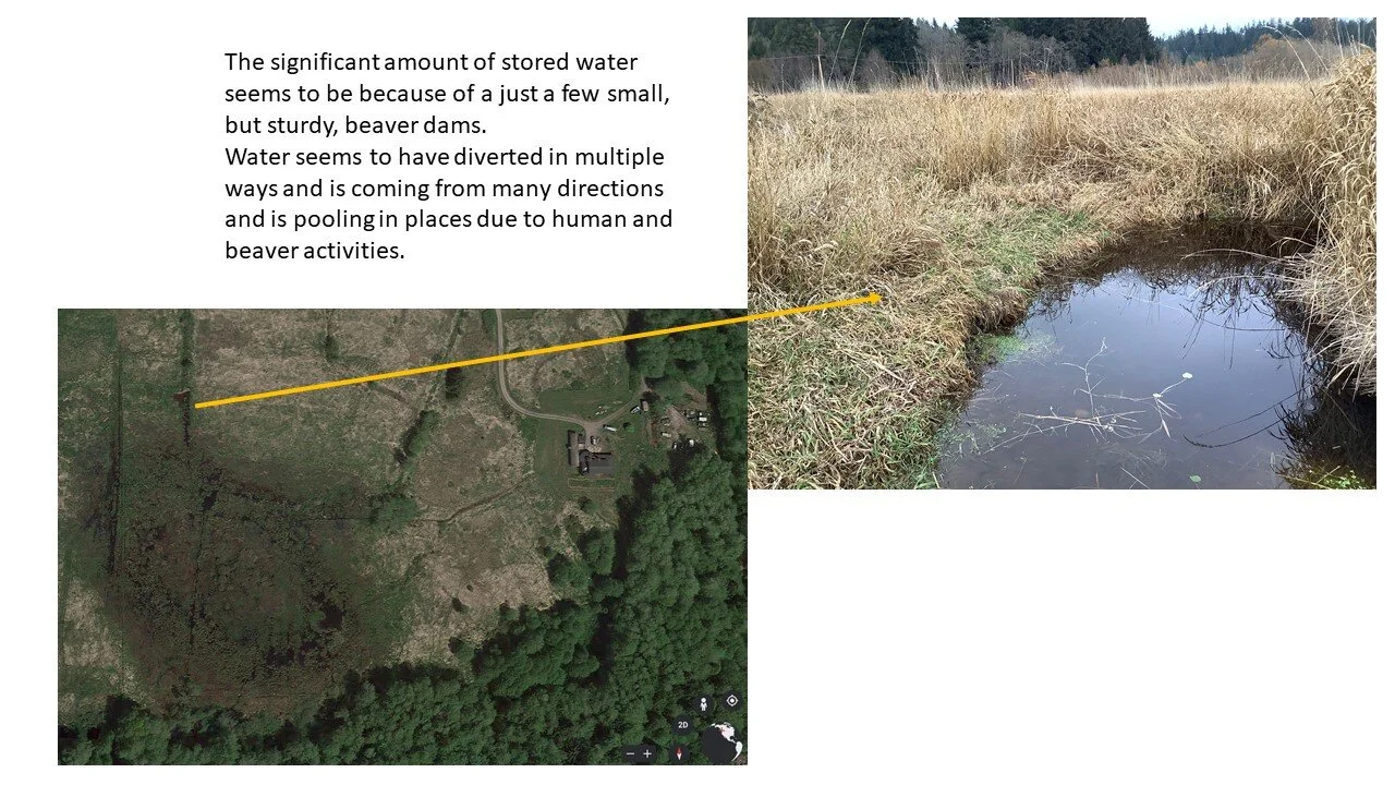
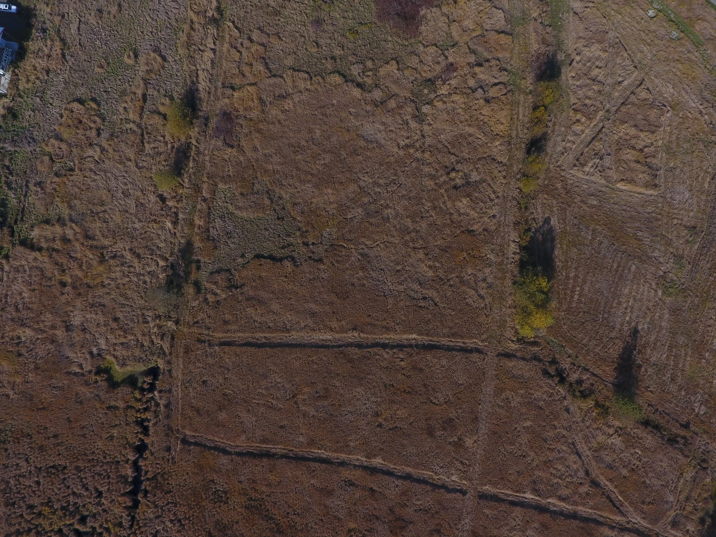
Gamble Creek Headwaters Aerial Photographs
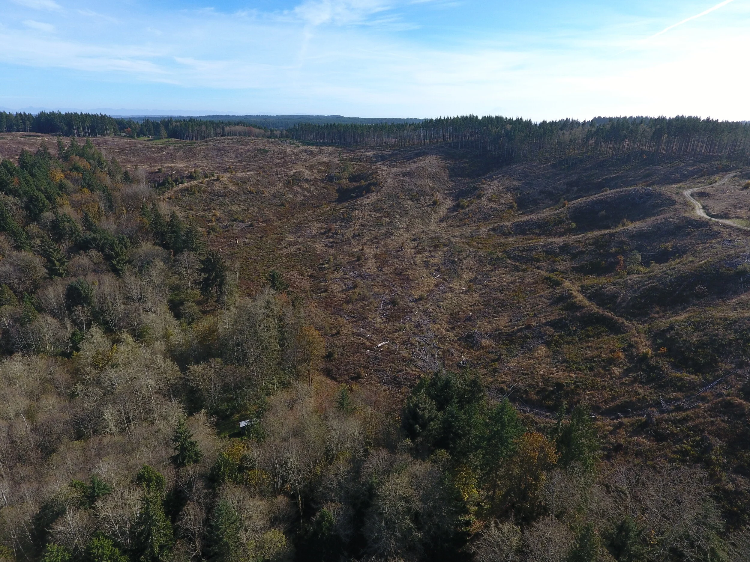

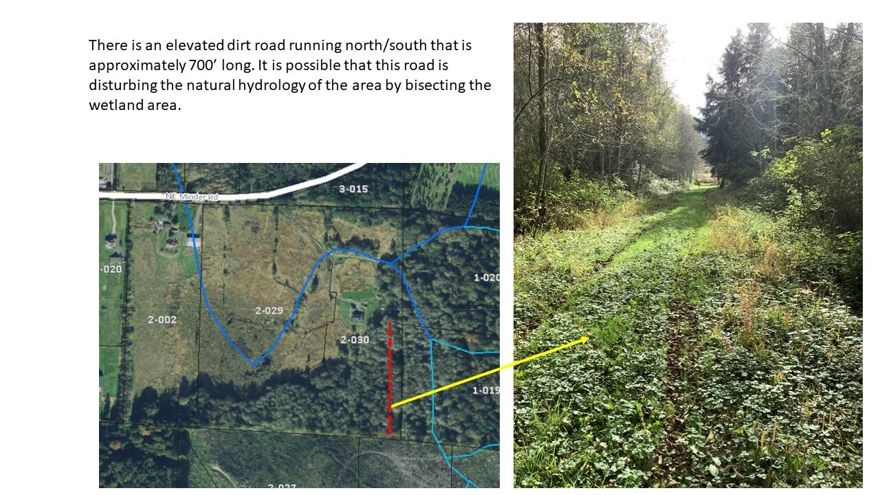
Northern divide Aerial Photographs